Volume 8, Number 1—January 2002
Perspective
Using a Dynamic Hydrology Model To Predict Mosquito Abundances in Flood and Swamp Water
Jeffrey Shaman , Marc Stieglitz, Colin Stark, Sylvie Le Blancq, and Mark Cane
Figure 1
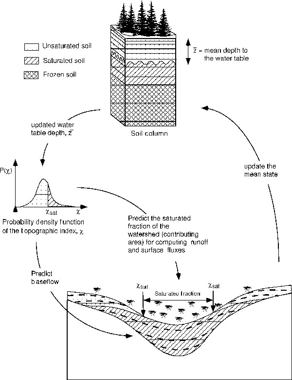
Figure 1. Visualization of the processing of land surface topography for a sample 25-km2 area in New York State. a) Digital Elevation Model--a pixelated (10 m cells) representation of land surface topography. Contour lines (in meters) have been overlain. b) Postprocessing, depiction of land surface wetness at a single point in time. Blue areas are wettest. The variability and spatial distribution of surface wetness are evident.
Page created: July 14, 2010
Page updated: July 14, 2010
Page reviewed: July 14, 2010
The conclusions, findings, and opinions expressed by authors contributing to this journal do not necessarily reflect the official position of the U.S. Department of Health and Human Services, the Public Health Service, the Centers for Disease Control and Prevention, or the authors' affiliated institutions. Use of trade names is for identification only and does not imply endorsement by any of the groups named above.